
Studying geography at night: Géocartie goes dark
Géocartie now follows your device's theme: maps, quizzes, leaderboard, and blog stay readable in the evening, with no settings to touch.
Studying at night without straining your eyes
A lot of studying happens late, in a dimly lit room. An all-white site is hard on the eyes at that hour. Géocartie now follows your device's theme: if your phone or computer is set to dark mode, the site displays in dark mode too; if it's set to light mode, nothing changes for you.
There's nothing to configure on the site itself, and so nothing to re-adjust from one device to another: your system decides, and Géocartie follows suit.
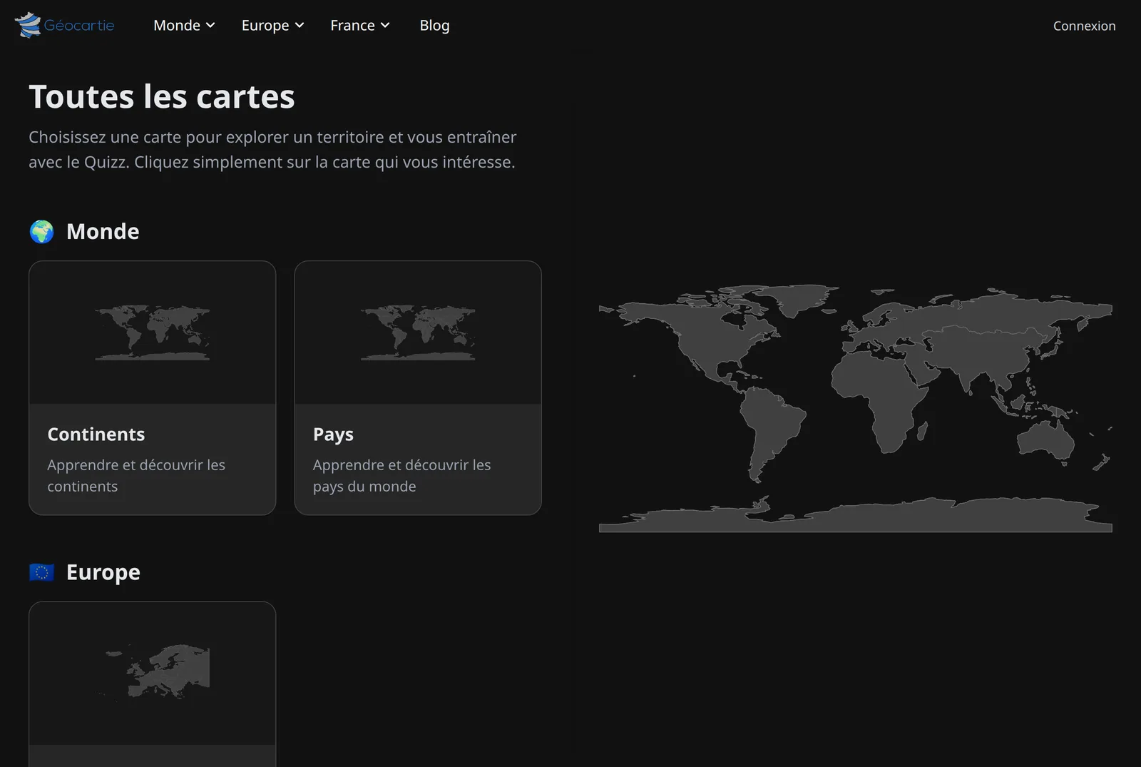
What's been adapted
Switching a site to dark mode isn't just about inverting colors. Every screen has been reworked to stay readable:
- maps, where territories, borders, and hover states have their own night-time palette — a clickable territory still visibly looks clickable;
- the quiz panel during a game, the score bar, and the focus mode button;
- the leaderboard, where your own row is still highlighted, now using a tint of the site's color instead of a plain light background;
- the map catalog, its preview cards and thumbnails;
- navigation, its dropdown menus and the header;
- the blog, the FAQ, the contact form, the account page, modal windows, and the cookie banner.
👉 See it for yourself on the countries of Europe or the continents — if your device is set to dark mode, the map will be too.
Why follow the system instead of adding a toggle?
A theme toggle adds a third state to manage — light, dark, "match system" — and gets out of sync the moment you switch devices. The preference already exists in your operating system, and your browser passes it along; respecting it is simply the least surprising behavior.
If you want to switch, the setting lives on your device: "Appearance" or "Theme" on a computer, "Display" on mobile. The site will follow as soon as you reload the page.
Spotted a display issue?
Dark mode touches nearly every screen on the site. If you run into unreadable text or a dull-looking map, let us know via the contact page — that's exactly the kind of detail we can fix quickly.
🎯 While you're at it. With a free account, your scores are saved from one session to the next — handy when your studying is spread across several evenings.